


Weekend Adventurers is reader-supported. If you purchase through affiliate links, I may earn a small commission, at no extra cost to you. All reviews are based on my own opinions.
Cadair Idris via the Minffordd Path is a classic Snowdonia route that is well worth the effort of the steep climb. Expect stunning views and epic ridgelines.
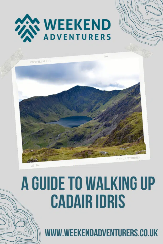
At the southern end of Snowdonia National Park, near the town of Dolgellau, is Cadair Idris. This mountain falls just short of 3000 feet, so doesn’t make it onto the revered list of Welsh 3000s (fifteen Welsh mountains over 3000 feet). However, Cadair Idris should not be bypassed because a few of its neighbours are slightly taller. This is a spectacular, and challenging hike that offers incredible views over the mountain lake of Llyn Cau.
Walking the Minffordd Path to Cadair Idris
The Minffordd Path offers a short but steep route to the summit, following the ridgeline of Craig Cau up to Penygadair. There are many hikers who will happily tell you that this is their favourite walk in Snowdonia, even Wales – a big statement considering just how many epic locations there are. Being at the southern end of the park, this mountain can sometimes seem much quieter than Snowdon itself but it’s no secret so you can expect to see a few people at the summit on a sunny day. 
I made an early morning solo trip to Cadair Idris back in March, just before the lockdown began. Fortunately, I picked a stunning morning for it and began walking just as the sun began breaking over the mountains.
PIN THIS

The walk begins very steeply up through a beautiful patch of old woodland. I’d only been walking for a few minutes before I was stopping to catch my breath, admire the waterfalls that fall through the woodland, and rethink the number of layers that I was wearing. But, once out of the woodland and out in the open again the trail began to level off for a little while as I made my way towards the hidden lake of Lynn Cau.
From the lake, the path heads steeply up to the left until it meets the ridgeline of Craig Cau. With most of the hard work done I was now free to wander along enjoying the views. The lake of Llyn Cau sits in a bowl, surrounded on three sides by steep mountains. From up on the ridgeline above you are treated to incredible views back down to where you have walked from and it’s easy to see why so many people love this walk.
It was still early by the time I’d reached this point and I was yet to see another walker. A couple of wild campers on the lake edge were the only other signs of life in an otherwise deserted scene. I decided that this was as good a place as any to sit for a while and make a coffee before continuing on up to the summit.
When is the Best Time to Walk the Minffordd Path?
The Minffordd path is well surfaced and fairly easy to follow, so this is a route that can be done all year round. But, this is proper mountain terrain and could be entirely different in winter conditions and poor visibility. The path follows a ridgeline for much of the way with exposed sections and steep drops.
If you’re tackling this in bad conditions then you need to know what you are doing and be able to navigate even in low visibility.
I started my walk just at first light and reached the lake just as the first signs of the sun were hitting the water. It was a beautiful time to be there and I’d definitely recommend heading out early for this hike.

The Route
The Minffordd Path is a circular route of around 9km and features some steep climbs. The walk will take four to five hours depending on your fitness and how long you spend admiring the views.
You can view the route here.
Facilities
For the Minffordd Path, park at the Dol Idris Car Park, postcode LL36 9AJ. You can start the trail by following the steep track up through the woodland behind the tea rooms.
Things to Do Nearby
There are plenty of adventures to be had in the nearby area if you are planning to make a weekend of it. Of course, this is the southern end of the Snowdonia National Park so there are plenty more mountains to climb.
If you are looking for something more relaxing after your Cadair Idris hike you could walk or cycle the Mawddach Trail, a 9-mile traffic-free route built on the site of a former railway line. The trail begins in Dolgellau and ends in Barmouth, crossing the iconic railway bridge over the estuary.
If you’re a mountain biker then the legendary trail centre of Coed-y-Brenin is nearby and features some of the best singletrack in the country.


